News
Utilization of the TACR project results in the activities of the Ralsko Geopark
Principal aim of the project “Database of old quarries and mine workings in the territory of the Bohemian Switzerland NP and Elbe Sandstones PLA” is the widest possible availability of the obtained results and their practical application. The new classification of historical mine workings and the procedures of their documentation, bulk experience from the field, and the published complex map-integrated database created within the TACR project may thus become a template to be followed in other sandstone areas. The first such case is the collaboration with the Ralsko Geopark, whose representatives and scientific workers visited the WE QUARRIES exhibition on 26 March 2024 (being guided by geologist Z. Vařilová). This way, presented information about recovered mining relics in the landscape of the Elbe Sandstones, descriptions of abandoned quarries and their visualization became an inspiration for the launched transboundary project „Virtual Museum: Man – Water – Stone“ (Interreg Czech Republic – Saxony 2021–2027) focused on the presentation of common cultural heritage based on natural resources of the near-border region. Among others, the project strives to present historical exploitation of stone and related crafts in the districts of Česká Lípa (CZ) and Görlitz (D), making use of the experience of workers of the Municipal Museum of Ústí nad Labem. Other institutions involved are the Regional Museum and Gallery in Česká Lípa, National Heritage Institute and the Institute of Ethnology of the Czech Academy of Sciences; a closer cooperation with experts from the Municipal Museum of Ústí nad Labem is also presumed.

![]()
26–27 October 2023, 10:00 AM to 4:00 PM
Autumn holiday in the museum
Two days full of educational and play activities for families with children and the wide public were organized in late October 2023. This event was a supplementary programme of the exhibition “WE QUARRIES: sandstone landscape in the hands of quarrymen”. The visitors were involved, among others, in working of various types of sandstone in a stonemason shop in the outdoor atrium of the museum, or in the construction of a loam kiln for iron smelting. Commented tours of the exhibition were run throughout the event. A popular-science lecture titled “The Elbe sandstone in historical buildings” was given by Kamil Podroužek and the lecture “Iron ores in sandstones – a history of mining and processing” was given by Natalie Belisová. The highlight of the whole event was the smelting of iron ore in the very centre of the regional city. 


Facebook post
12 September / 17 October / 29 November 2023
Commented tours of the exhibition with the project investigators
A series of three special commented tours with the principal project investigators (a geologist, a regional scientist and a construction historian) was organized from September to November 2023. Each of the tours lasted over 90 minutes, being focused on specific topics depending on the specializations of the guiding experts. The interest in the subjects studied among the public was documented by the wide attendance and numerous inquiries with a discussion.


Facebook post: Exhibition – MY LOMY with Zuzana Vařilová
Facebook post: Exhibition – MY LOMY with Natalia Belisová
Facebook post: Exhibition – MY LOMY with Kamil Podroužek
22 June 2023
Opening day of the exhibition
A ceremonious opening of the exhibition “WE QUARRIES: sandstone landscape in the hands of quarrymen” (23 June 2023 – 28 January 2024, extended till 8 April 2024) was held on Thursday 22 June 2023 at 5:00 PM. The event was attended by majority of the team of authors, and was presented in a regional TV and in local media. 


Photos from the opening: https://www.facebook.com/muzeumusti
Opening of the exhibition on Youtube
Opening of the exhibition on Naseveru.net
For additional details see: MY LOMY
23–27 May 2023
Presentation of the project at an international symposium
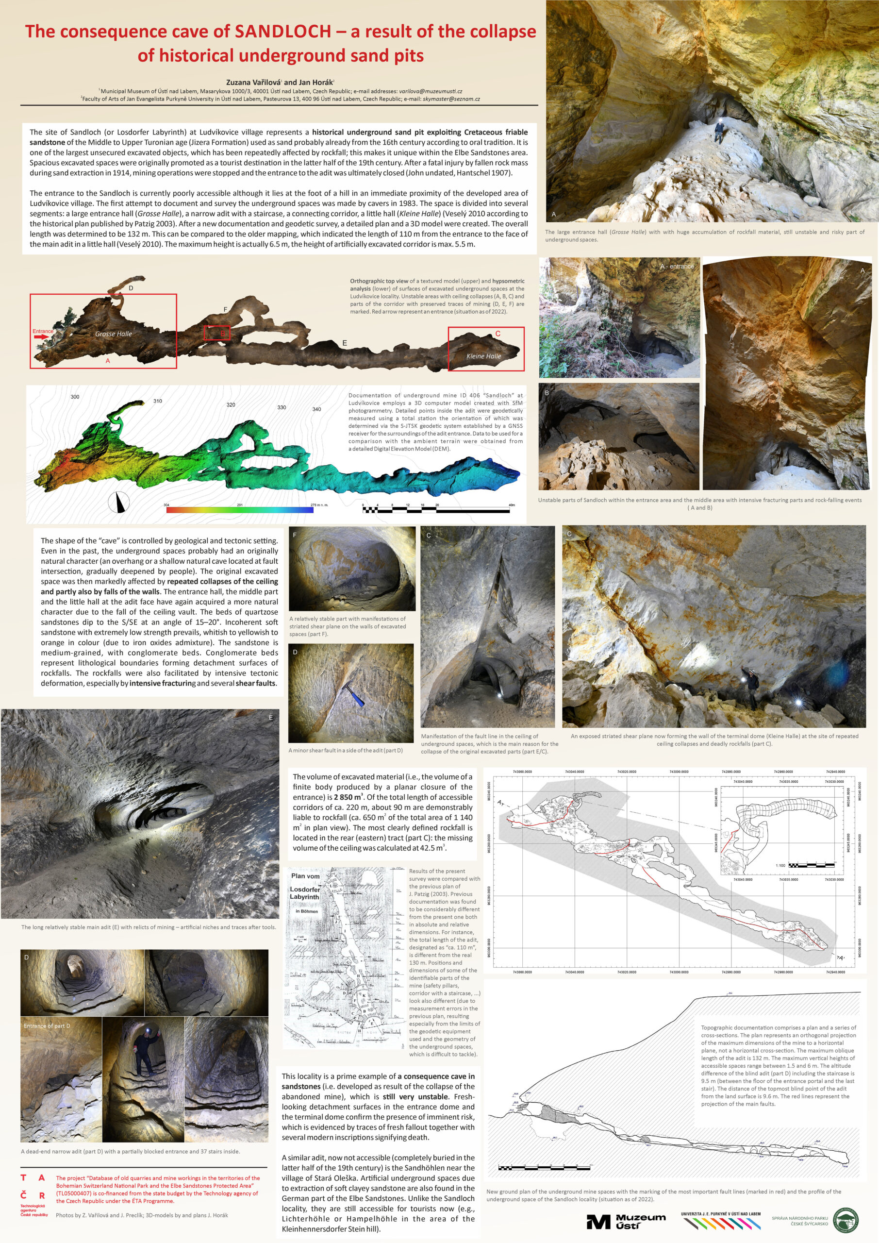
Particular results of the TAČR project were presented in the form of two posters by Z. Vařilová at the “14th Symposium on Pseudokarst” (Karłów, Poland). Abstracts to the posters titled “Changes in the relief of sandstone cliffs due to historical stone quarrying” and “The consequence cave of Sandloch – a result of the collapse of historical underground sand pits” are incorporated in the Book of Abstracts from the conference.
26 October 2022
WORKSHOP
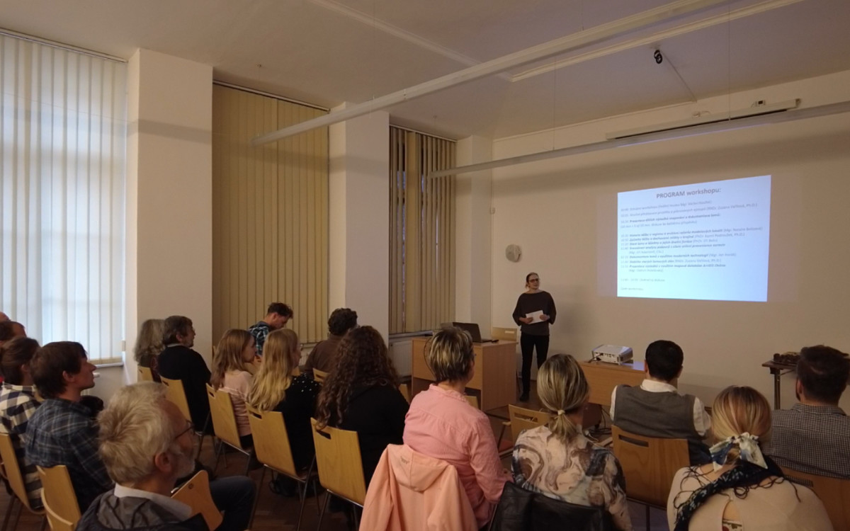
A workshop scheduled within the project “Database of old quarries and mine workings in the territories of the Bohemian Switzerland National Park and the Elbe Sandstones Protected Landscape Area” financed by the TAČR (ÉTA programme) took place on Wednesday, 26 October 2022. The purpose of the workshop was to present this inter-disciplinary project to the invited representatives of universities, state cultural heritage bodies, nature conservation bodies, of the Regional Office and other audience including experts, journalists and other potential recipients of the project results. Individual themes of the project and partial results of the study (obtained in the first 18 months of project solution) were presented including the detected pitfalls in the study of archival sources, descriptions of old mine workings and preserved relicts in the landscape. Some of the prepared outputs were also presented (online GIS database, visualization and 3D modelling). Topical issues related to, e.g., building stone provenance or stability of old quarry faces were covered, too.
For additional details see www.facebook.com/muzeumusti/
For a record of lectures presented at the workshop of 26 October 2022 see
https://www.youtube.com/playlist?list=PLpjnbS91cGZpKDTtDWQtYZV3sfKrF5Z3e
7–8 September 2022
Project presentation at the congress
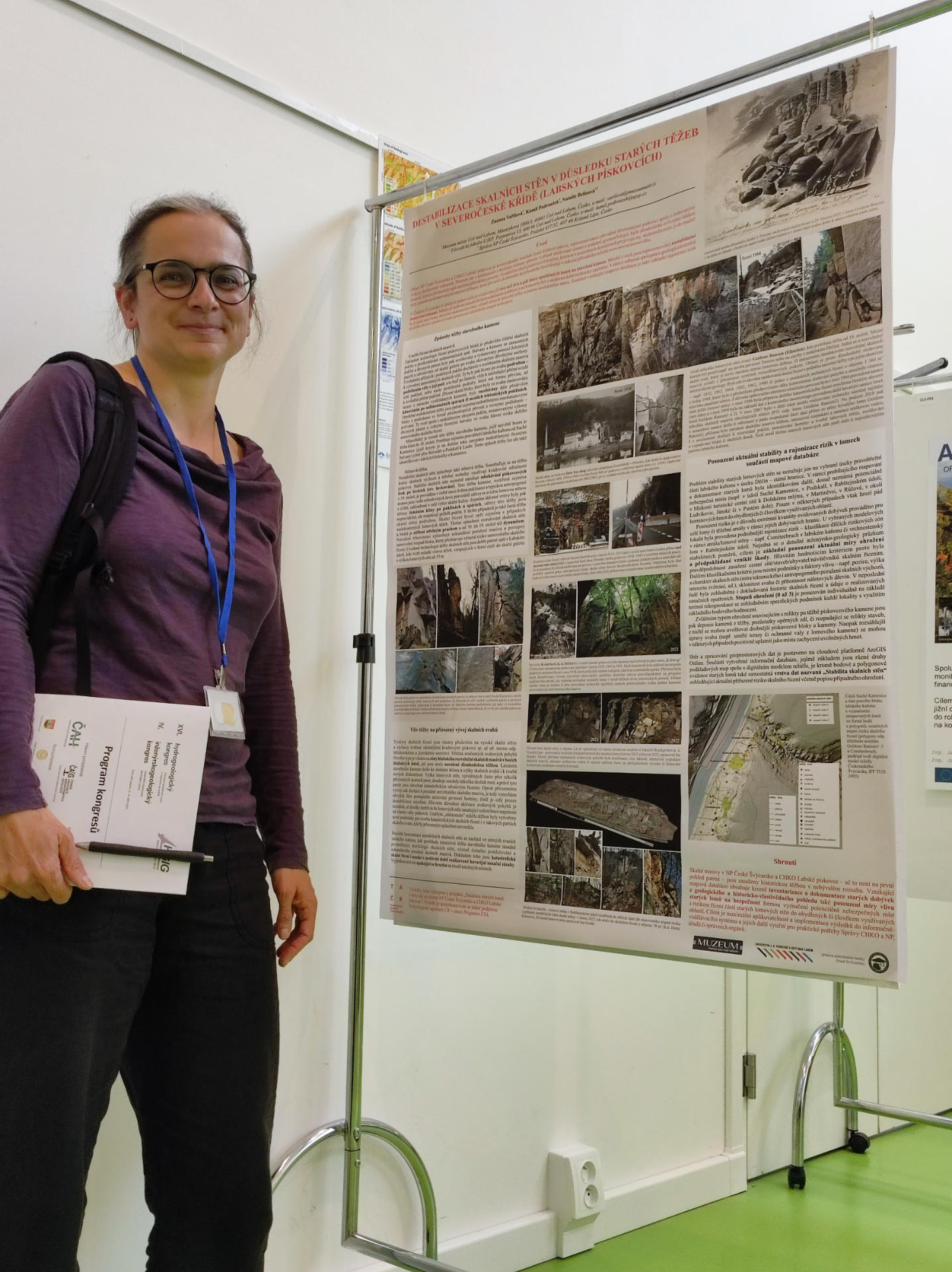
The theme of “stability of old quarry faces and scaling of rockfall risk” was presented in the form of a poster by Z. Vařilová at the “HG and IG Congress” held in Ústí nad Labem on 7–8 September 2022. The theme was included in section “IG9 Slope movements and other geodynamic phenomena” (P04). A scientific paper expanding the poster, titled “Deterioration of cliff face stability induced by old mining in North Bohemian Cretaceous (Elbe Sandstones)” and representing partial results of the TAČR project, was published in the online conference proceedings.
For further details on the Congress see https://hgig.cz/

Více o kongresu zde: https://hgig.cz/
26 May 2022
Lecture for the public
Mineral exploitation (including new discoveries made within the TAČR project) was the subject of a popular-science lecture by Z. Vařilová and N. Belisová at Coffee&Books organized in Děčín on 26 May 2022. The lecture titled “Geology of the Bohemian-Saxonian Switzerland” was one of the thematic events of Café Nobel.


(foto © Frederik Velinský, UJEP)
Scientific team
Principal investigators:
Municipal Museum of Ústí nad Labem, p. o.
Jan Evangelista Purkyně University (Cultural Heritage Documentation and Digitization Centre at the Philosophical Faculty)
Collaborating entity: Bohemian Switzerland NP Administration
Scientific team:
RNDr. Zuzana Vařilová, Ph.D. – geologist, project co-ordinator
Mgr. Natalie Belisová – regional scientist (history/archives)
PhDr. Kamil Podroužek, Ph.D. – historian
Mgr. Jan Horák – documenter and technician
PhDr. Jiří Belis – historian and conservation technician/documenter
Mgr. Oldřich Holešinský – GIS administrator
Other collaborators:
– Museum staff (photographer, field assistant)
– Documentation Centre staff (documenter/GIS)
– external collaborators (survey and documentation of selected sites, special investigations, laboratory analyses etc.)

Aims of the project
Partial aims and topics studied
- Survey and documentation of workings in the area of interest – presentation of results via a comprehensive map database
- Acquisition of new material and immaterial evidence of mining with an emphasis on local topography and history of utilization of local landscape
- Provenance determination of building stone in historical buildings and monuments – search for evidence of local material utilization
- Assessment of mining impacts (the scale of intervention into sandstone landscape and alterations of natural sandstone relief)
- Evaluation of the present state and possible risk – the effect of old quarries and mine workings on safety (stability of cliff faces above settlements and communication routes, rick of rockfall and subsidence above old mine workings; state and secondary utilization of quarries)
The widest possible availability of results and their application in practice: implementation of the results in the information-educational system and in the behaviour of selected subjects to the benefit of their activities and their decision-making, as an input for the elaboration of land-use plans; including a possible presentation of results via existing online information and map portals (NP and PLA administrations, Regional Office, Czech Geological Survey, National Heritage Institute etc.)
Activities and deliverables
Activities and deliverables
- Review of available literature, maps, unpublished studies and archival sources;
- Systematic and complex coverage of topics related to sandstone extraction, marginally also to the extraction of volcanics, limestone, granitoids and ores;
- Field mapping and survey of the whole area of interest (overall extent of 324 km2);
- Registering and description of abandoned quarries and workings in geological and regional-historical viewpoints using modern technologies and methods;
- Inclusion of obtained data in a comprehensive map database (GIS);
- Formulation of basic typology of sandstone quarries and workings, characteristics of preserved mining relics;
- Detailed documentation of 10 model sites (a detailed plan or 3D model of the site, calculation of the volume of extracted material, documentation of the stratigraphy of mining and the road system, detailed characteristics of geological setting and rock descriptions etc.);
- Development of the theme of local sandstone utilization. Identification of the sources of sandstone used for the construction of historical monuments in the Děčín and Litoměřice areas. Definition of basic petrographic characteristics of sandstone from specific quarries demonstrably used as building stone or millstone;
- Survey of potentially hazardous quarry faces, scaling of rockfall risk (including a proposal for a methodology of hazard/rik assessment in old quarries);
- Presentation of the project topics 1) to the professional public (via a workshop, conference presentations, publication of scientific papers and a research report) and 2) to the broad public using a science-promotion format (via a museum exhibition, lectures and accompanying events for families with children).


Project deliverables:
- Workshop (W – Workshop organization)
Scheduled delivery deadline: 31 October 2022 - Publications (papers) with partial results of the study
(Jost – Other papers in peer-reviewed scientific periodicals)
Scheduled delivery deadline: during 2023 (not later than 31 Dec. 2023) - Exhibition (E – Exhibition organization)
Opening of the exhibition scheduled for June 2023, closure for December 2023 with a possibility of extension - A professional map file together with an information database
(Nmap – Specialized map with professional contents)
Scheduled delivery deadline: 31 December 2023 - Summary research report (Vsouhrn – Summary research report)
Scheduled delivery deadline: 31 December 2023
References to media
Press release of 30 April 2021 to be downloaded HERE
Vařilová Z. (2021): Dokumentace starých lomů – úspěšný projekt TAČR. [Documentation of old quarries – a successful TAČR project] Příspěvky k ústecké vlastivědě 2021, No. 23, p. 72–73.
Ústečtí muzejníci vyrážejí bádat do nestabilních skal Labských pískovců. [Staff of Ústí museum out to conduct research in unstable cliffs of the Elbe Sandstones] Ustecky.denik.cz, 30. 4. 2021.
https://ustecky.denik.cz/zpravy_region/muzeum-usti-badani-tezba-piskovec-20210430.html
Geologové vyrážejí bádat do skal. [Geologists heading out for research in the cliffs] Právo, 5. 5. 2021.
Muzeum a FF spolupracují na projektu TA ČR. [Museum and the Philosophical Faculty collaborating over a TAČR project] Ujep.cz, 6. 5. 2021.
https://www.ujep.cz/cs/30035/muzeum-a-ff-spolupracuji-na-projektu-ta-cr?fbclid=IwAR1KQGMIB7LR0OxAjj1YVuylYTHP727kwnUyGDcctEkLoq0YQynRsEXRhkg
Ústečtí muzejníci vyrážejí bádat do nestabilních skal. [Staff of the Ústí museum heading out to study unstable cliffs] Mistnikultura.cz, 11. 5. 2021.
https://www.mistnikultura.cz/ustecti-muzejnici-vyrazeji-badat-do-nestabilnich-skal
Pískovcová krajina v rukách lamačů kamene. Ústecké muzeum připravilo zajímavou výstavu My lomy. [Sandstone landscape in the hands of quarrymen. Municipal museum of Ústí nad Labem has prepared an interesting exhibition WE QUARRIES] Naseveru.net, 23. 6. 2023.
https://www.naseveru.net/2023/06/23/piskovcova-krajina-v-rukach-lamacu-kamene-ustecke-muzeum-pripravilo-zajimavou-vystavu-my-lomy/
ÚSTÍ N.L: Výstava „MY LOMY: Pískovcová krajina v rukách lamačů“ přibližuje těžbu pískovce. [The exhibition WE QUARRIES brings the topic of sandstone mining closer to people] Regionální televize Ústecka, 29. 6. 2023.
https://www.youtube.com/watch?v=HdLCxydv5kQ&list=PL_1b0ipILhY_jdk92cYIPWWu-3N-rfL0r&index=6
V ústeckém muzeu začala nová výstava o starých lomech v Labských pískovcích. [A new exhibition about the old quarries in Elbe Sandstone area has started in the Municipal museum of Ústí nad Labem] Sever rozhlas.cz, 23. 6. 2023.
https://sever.rozhlas.cz/v-usteckem-muzeu-zacala-nova-vystava-o-starych-lomech-v-labskych-piskovcich-9020289
Municipal Museum of Ústí nad Labem, p. o.
RNDr. Zuzana Vařilová, Ph.D.
e-mail: varilova@muzeumusti.cz
Phone: + 420 475 210 937
Cell phone: + 420 773 541 535
Jan Evangelista Purkyně University (Cultural Heritage Documentation and Digitization Centre at the Philosophical Faculty)
PhDr. Kamil Podroužek, Ph.D.
e-mail: kamil.podrouzek@ujep.cz
Phone: + 420 475 286 459
Cell phone: + 420 725 836 413
RESULTS
- Workshop: 26 October 2022, from 10:00 AM in the Municipal Museum of Ústí nad Labem
At the workshop, the project participants will present the latest results of the inter-disciplinary research from years 2021–2022, methods used, interesting facts as well as the identified pitfalls.
The aim of the workshop is the presentation of the project at the presence of the investigators, representatives of educational institutions, nature conservationists and cultural heritage workers who pose the potential recipients of the project results. In the discussion, we intend to go through any possible requirements and suggestions towards a more effective use of application results.
PROGRAMME:
-
- Workshop opening, welcome of the participants (Museum Director Mgr. Václav Houfek)
- A brief introduction to the project and scheduled outputs (RNDr. Zuzana Vařilová, Ph.D.)
Presentation of partial results of quarry survey and documentation (20 min. + 5 to 10 min. discussion over each contribution): - History of mining in the region and archival review of the model sites (Mgr. Natalie Belisová)
- Mining techniques and preserved relics in the landscape (PhDr. Kamil Podroužek, Ph.D.)
- Old quarries and mining sites and their function in the present landscape (PhDr. Jiří Belis)
- Comparative analyses of sandstone samples aimed at provenance determination of the building materials (Mgr. Jiří Adamovič, CSc.)
- Documentation of quarries using modern technologies (Mgr. Jan Horák)
- Stability of old quarry faces (RNDr. Zuzana Vařilová, Ph.D.)
- Presentation of results employing the ArcGIS Online map database (Mgr. Oldřich Holešinský)
- Concluding discussion
For additional details see www.facebook.com/muzeumusti/
For a record of lectures presented at the workshop of 26 October 2022 see
https://www.youtube.com/

- Exhibition “WE QUARRIES: sandstone landscape in the hands of quarrymen” (23 June 2023 – 8 April 2024)
Exhibition curator: Zuzana Vařilová
Architectonic implementation: Jan C. Löbl
Graphic visual: Marek Fanta and Adéla Bierbaumer
Design and typesetting of information panels: Vladimír Cettl, Zuzana Vařilová
Exhibition realization: Jakub Doležel, Jan C. Löbl, Jiří Belis, Zuzana Vařilová, Martin Novák
Authors of texts: Natalie Belisová, Zuzana Vařilová, Jiří Belis, Kamil Podroužek, Jan Lokajíček
Creation of 3D models: Jan Horák
Creation of video projection: Jan Horák, Zdeněk Svejkovský
Creation of maps: Oldřich Holešinský
Author of drawings: Luděk Marks
Authors of photos: Jiří Preclík, Zuzana Vařilová, Kamil Podroužek, Natalie Belisová, Jan Horák, Václav Sojka, Ivan Peřina, Zita Tončerová, accompanying photographic documentation of the project and free works (Wikimedia Commons, Deutsche Fotothek etc.)
Specimens on display: Municipal Museum of Ústí nad Labem, private collection of Jiří Belis and Natalie Belisová, private collection of Kamil Podroužek, Bohemian Switzerland National Park Administration, Ladislav Krejza (sandstone ashlars), Association of Youth Tourist Clubs of the Czech Republic (millstone from the Oparno Mill), Vladimír Ort (quarrymen tools), field collections within the project
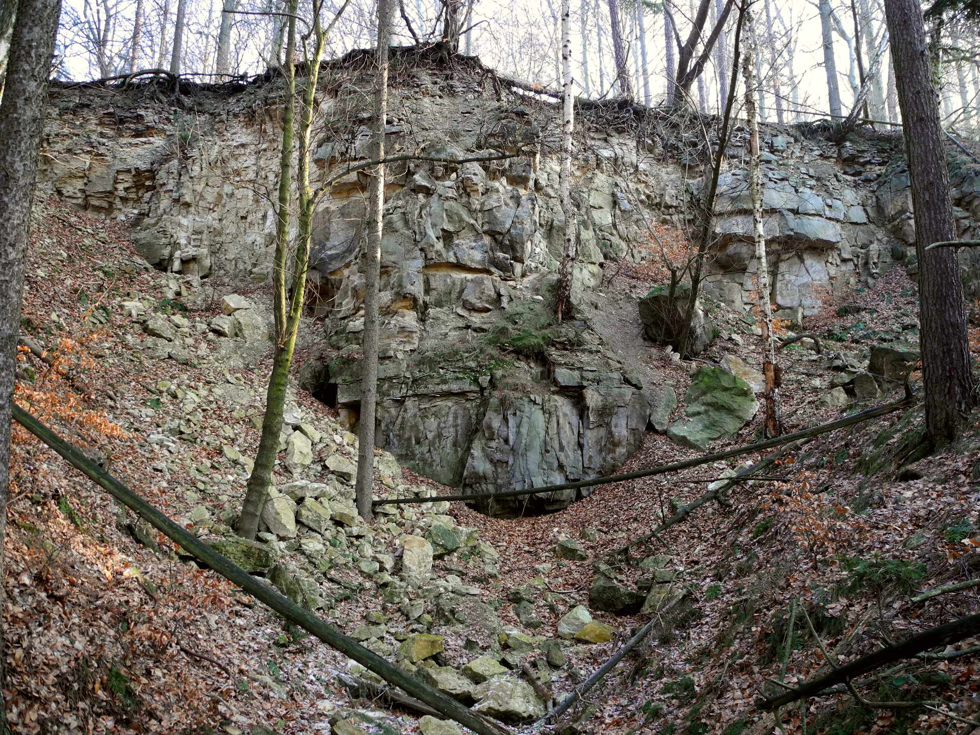
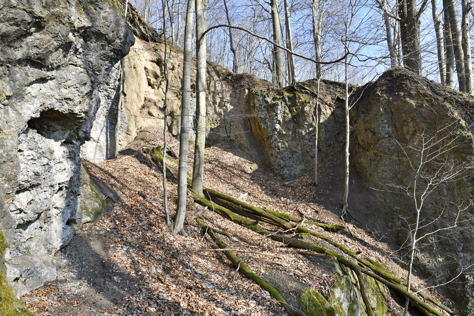
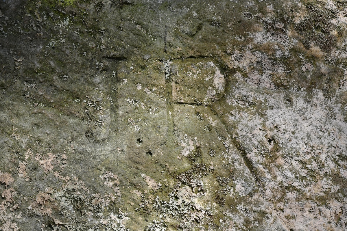
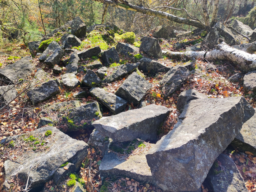
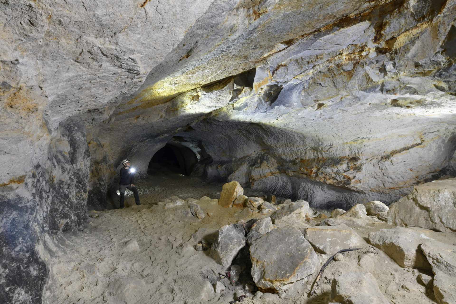
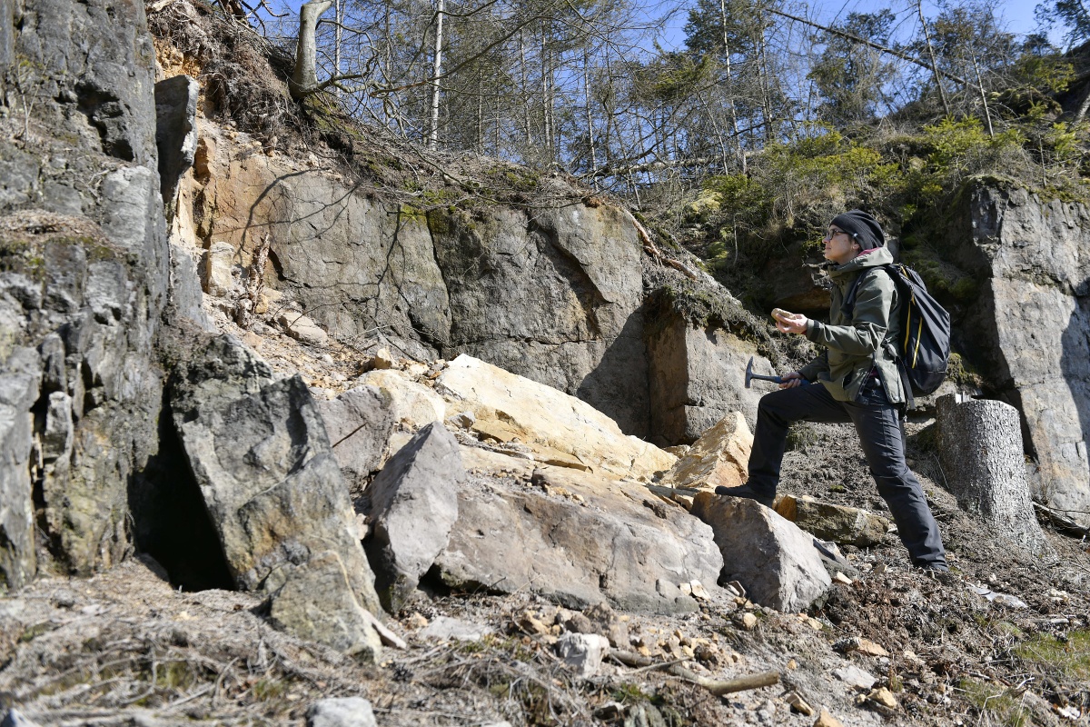
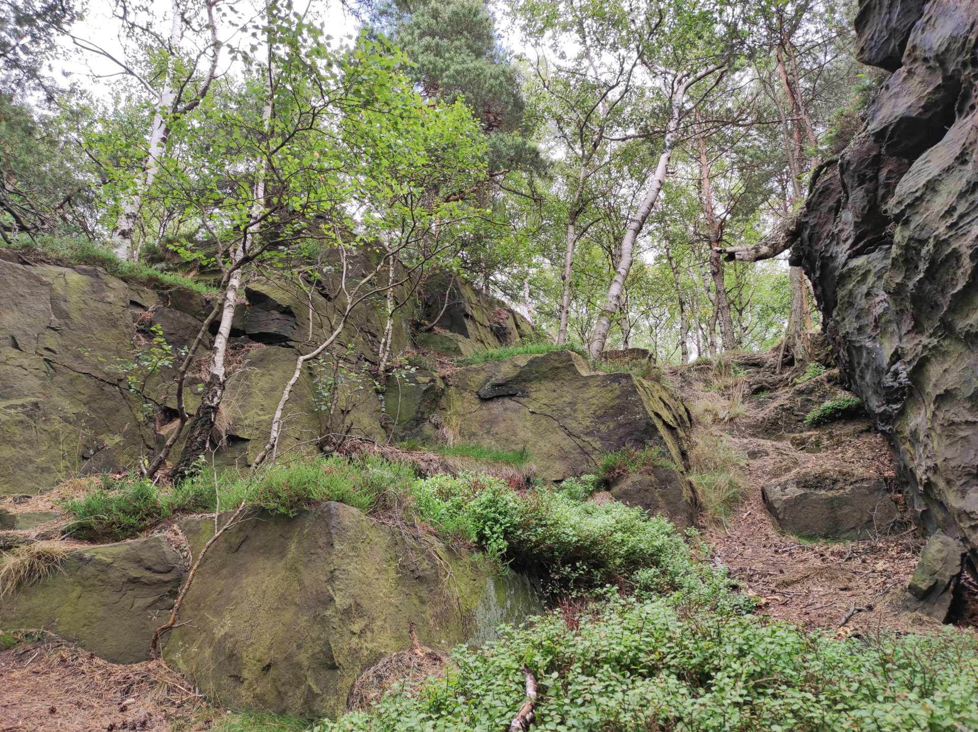
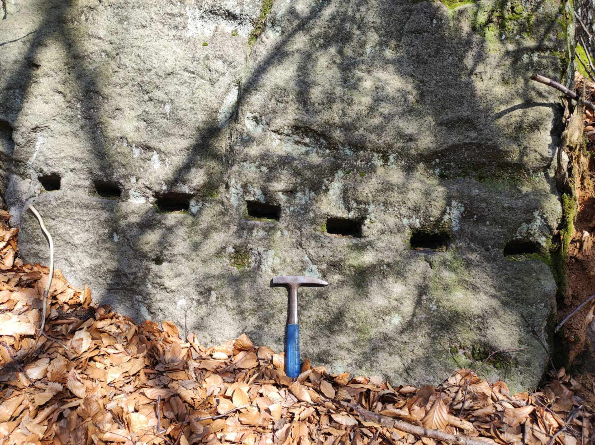
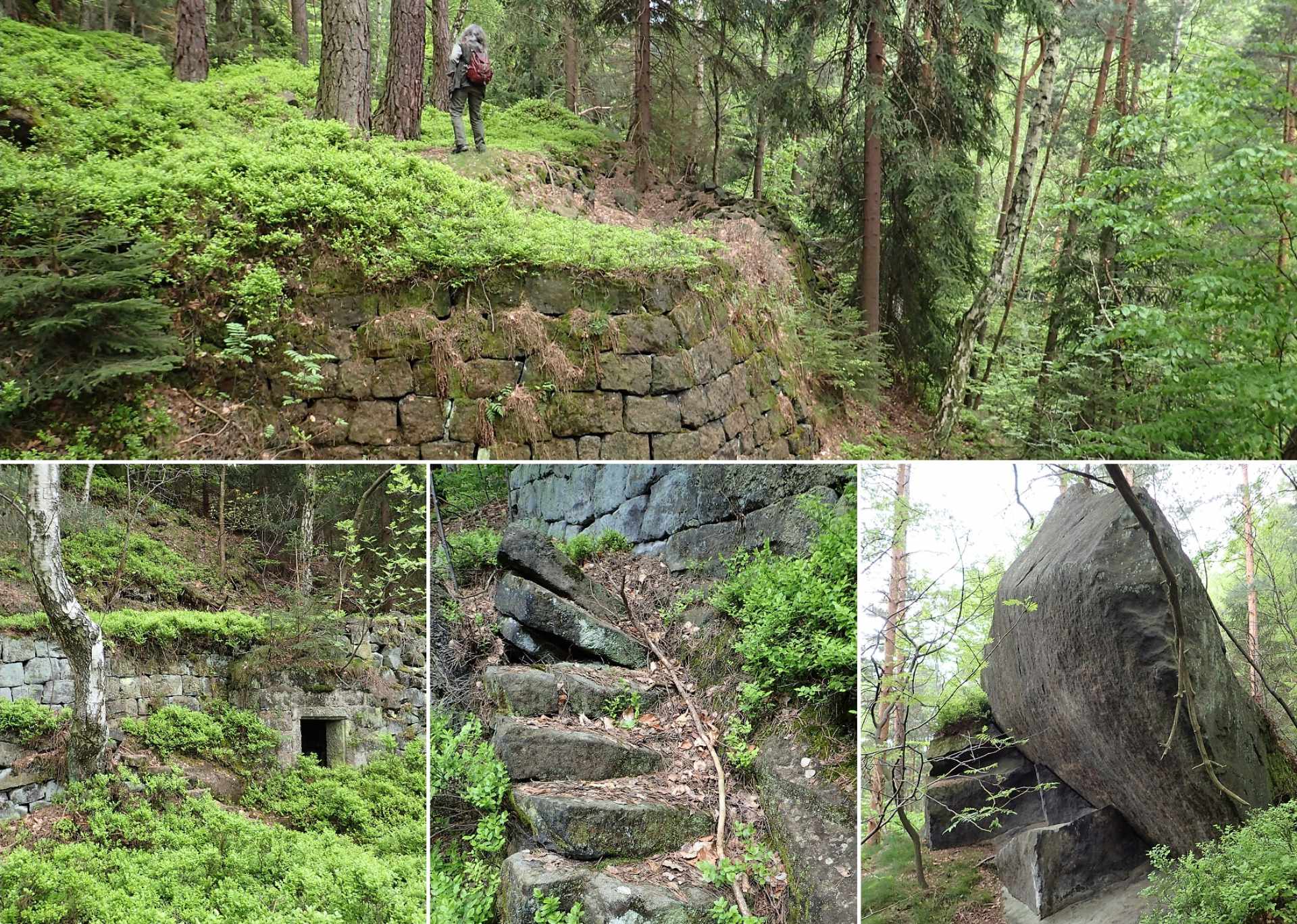
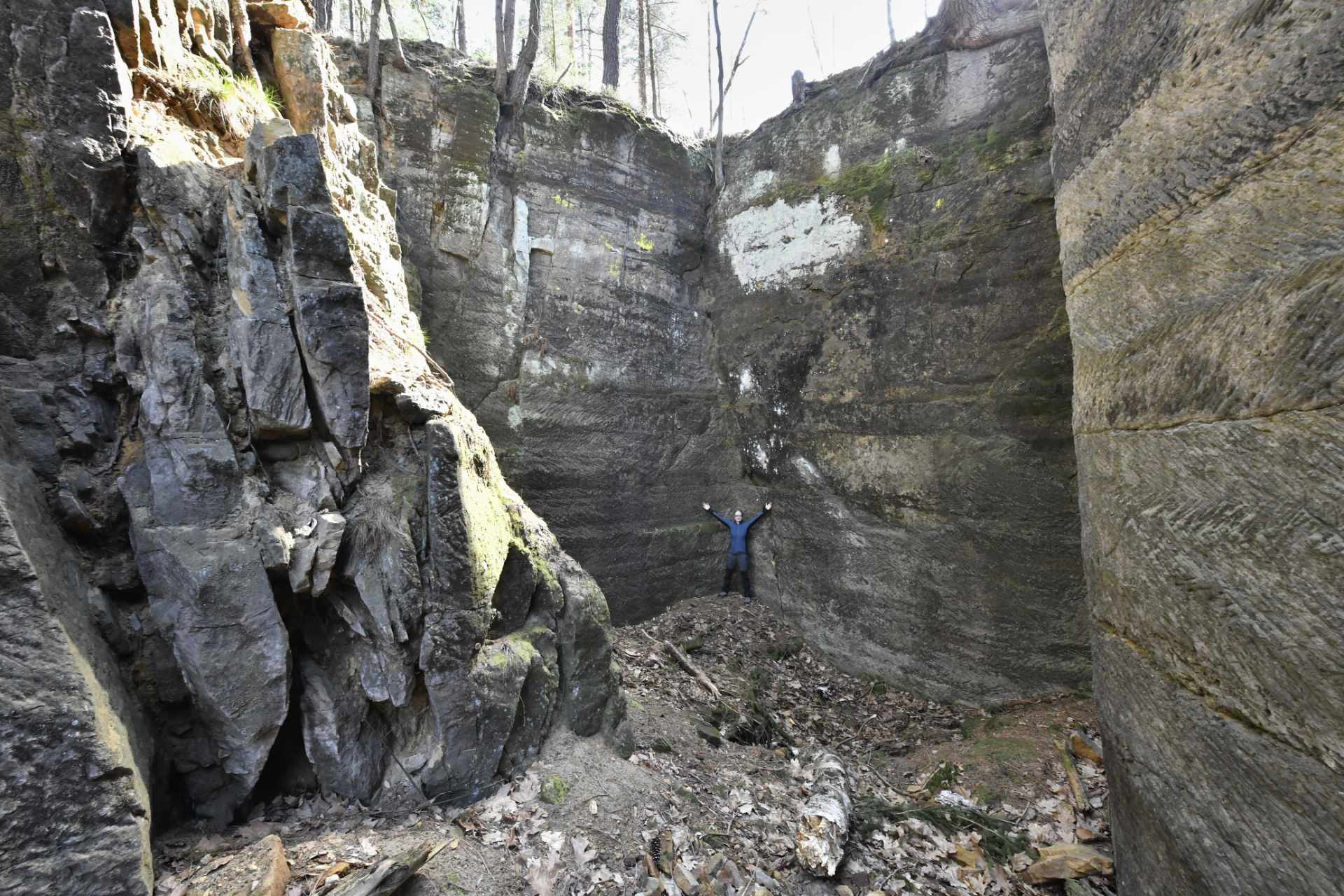
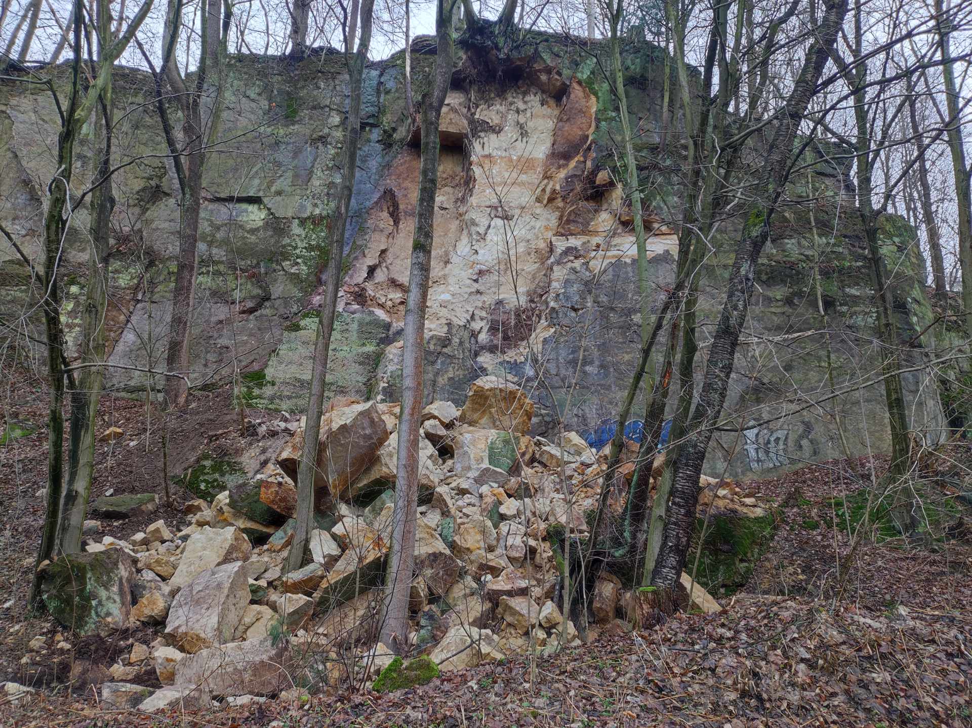
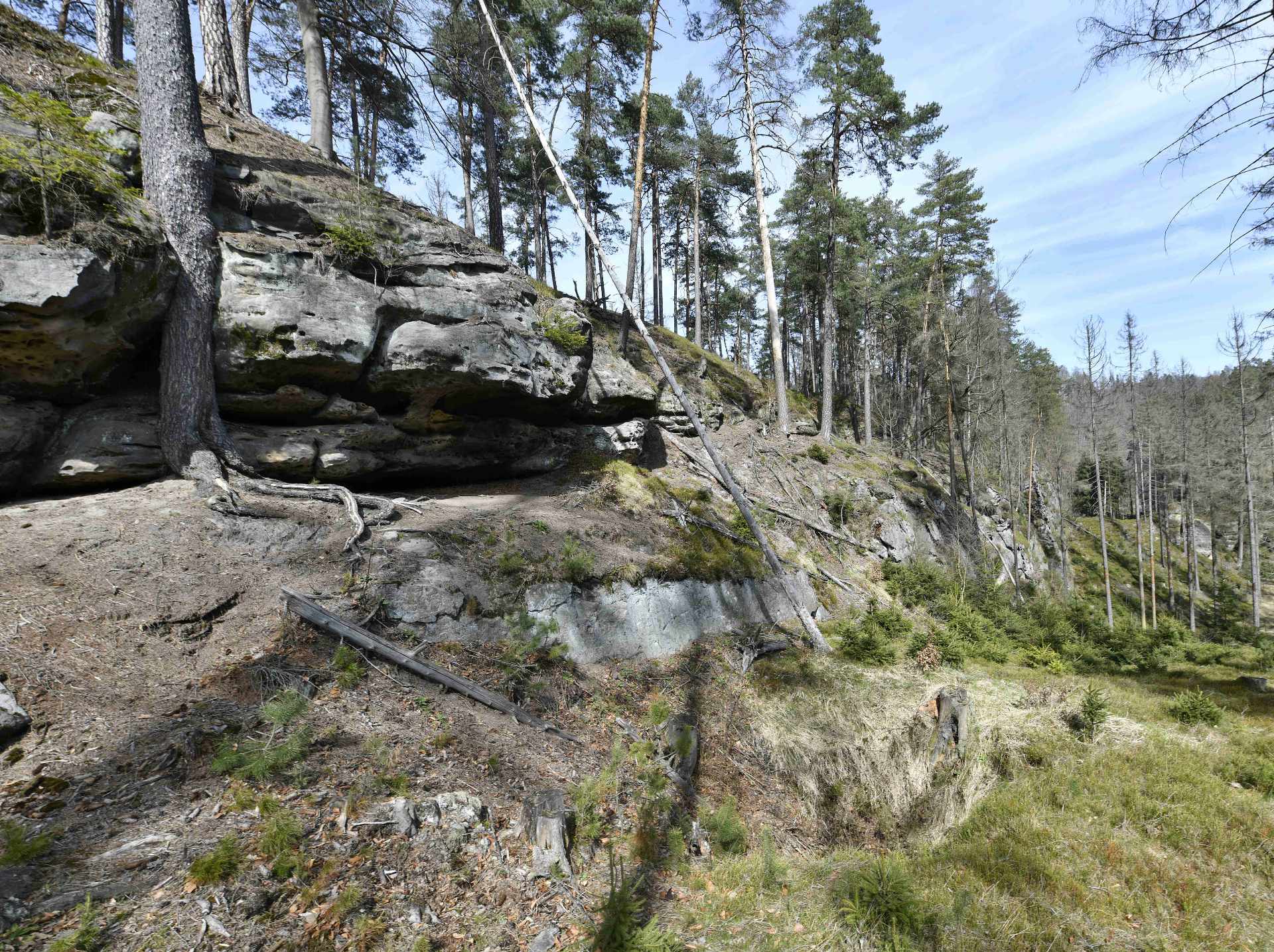
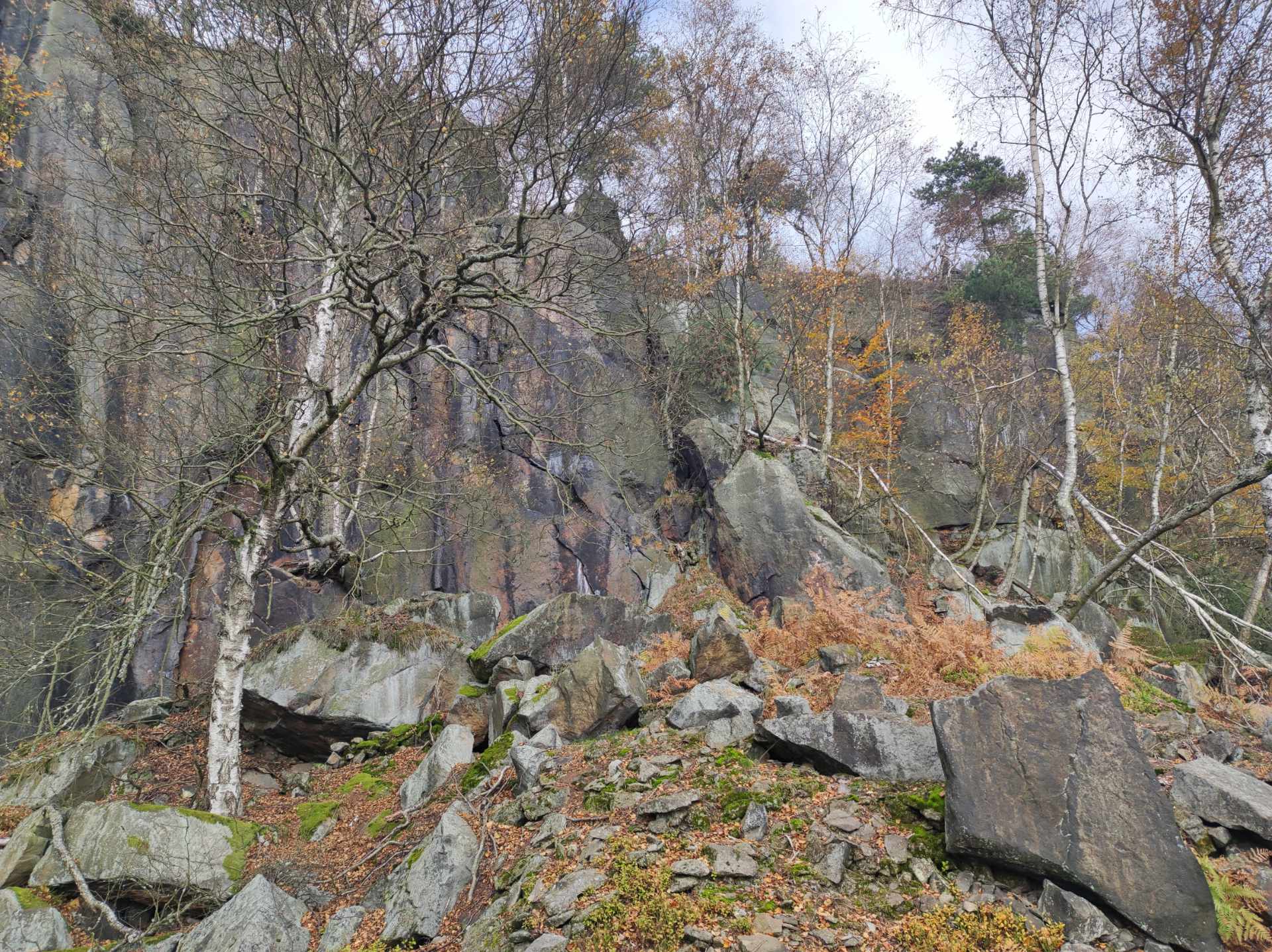
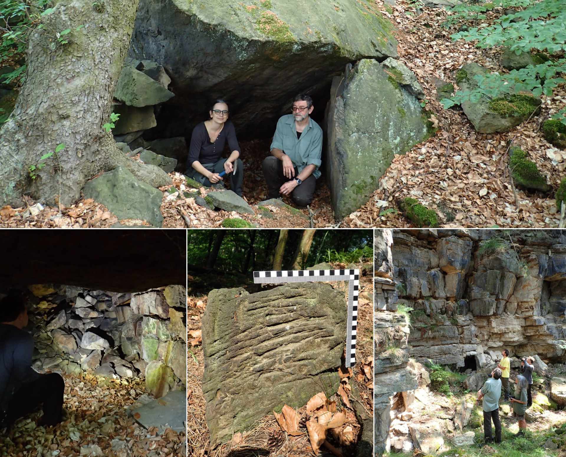
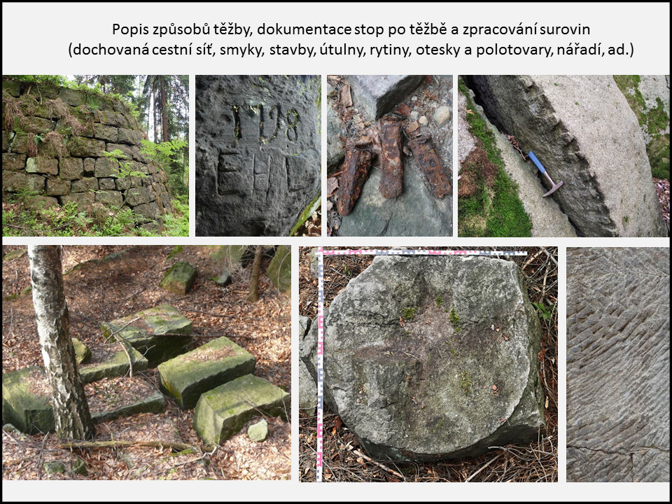
The exhibition, housed in three halls of the Municipal Museum of Ústí nad Labem, presents the visitors with the results of study of over 3,000 quarries which were discovered and surveyed by the North Bohemian historians and geologists in the last two years within the research project “Database of old quarries and mine workings in the territories of the Bohemian Switzerland National Park and the Elbe Sandstones Protected Landscape Area”. The exhibition points to the degree of change induded on the Elbe Sandstones landscape relief by human activity related to building-stone extraction. Hints for the identification of abandoned quarries in the landscape are provided by the photographic documentation from the field. These quarries sometimes manifest themselves only by traces after tools on the walls. In other cases, inscriptions and datings were carved by the stonemasons. Cellars used for the storage of tools, food and explosives by the quarrymen have been also preserved. Minute inconspicuous workings are encountered as well as giant quarries hundreds of metres long.
At the exhibition, the visitors can experience entering a sandstone quarry, having a chance to see the specific tools used by the quarrymen in their work and some of their smaller-size products, such as millstones and whetstones, architectural elements or railway milestones. With no major machinery, using mostly their hands, they managed to manipulate with large sandstone blocks. The exhibition also presents notorious monuments (e.g., St. Vitus Cathedral at the Prague Castle, the Terezín Fort, the Děčín Chateau or the Herrenhaus in Dresden) constructed from the very sandstone quarried in the Elbe River canyon and its close vicinity.
The whole explored area has an extent of 323 km2, extending from Petrovice to Mikulášovice. Besides about 2,500 sandstone quarries, it also features hundreds of quarries exploiting other rocks such as sand, basalt, granite, limestone, schist, iron ores and fluorite. Even these quarries are presented in detail at the exhibition, displaying geological specimens much like detailed digital 3D models of the quarries and mining relics. In a playful manner, the exhibition also presents an example of a map database of old quarries and mine workings, which is planned to be completed and made accessible to the public in the next year.


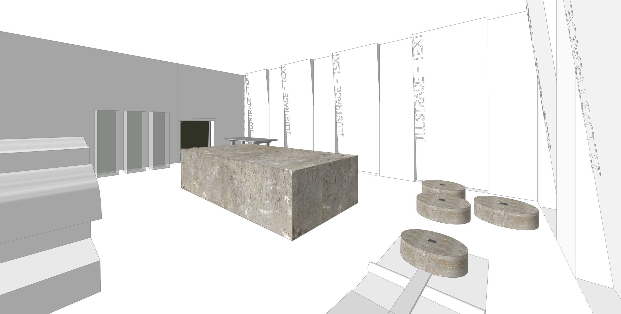
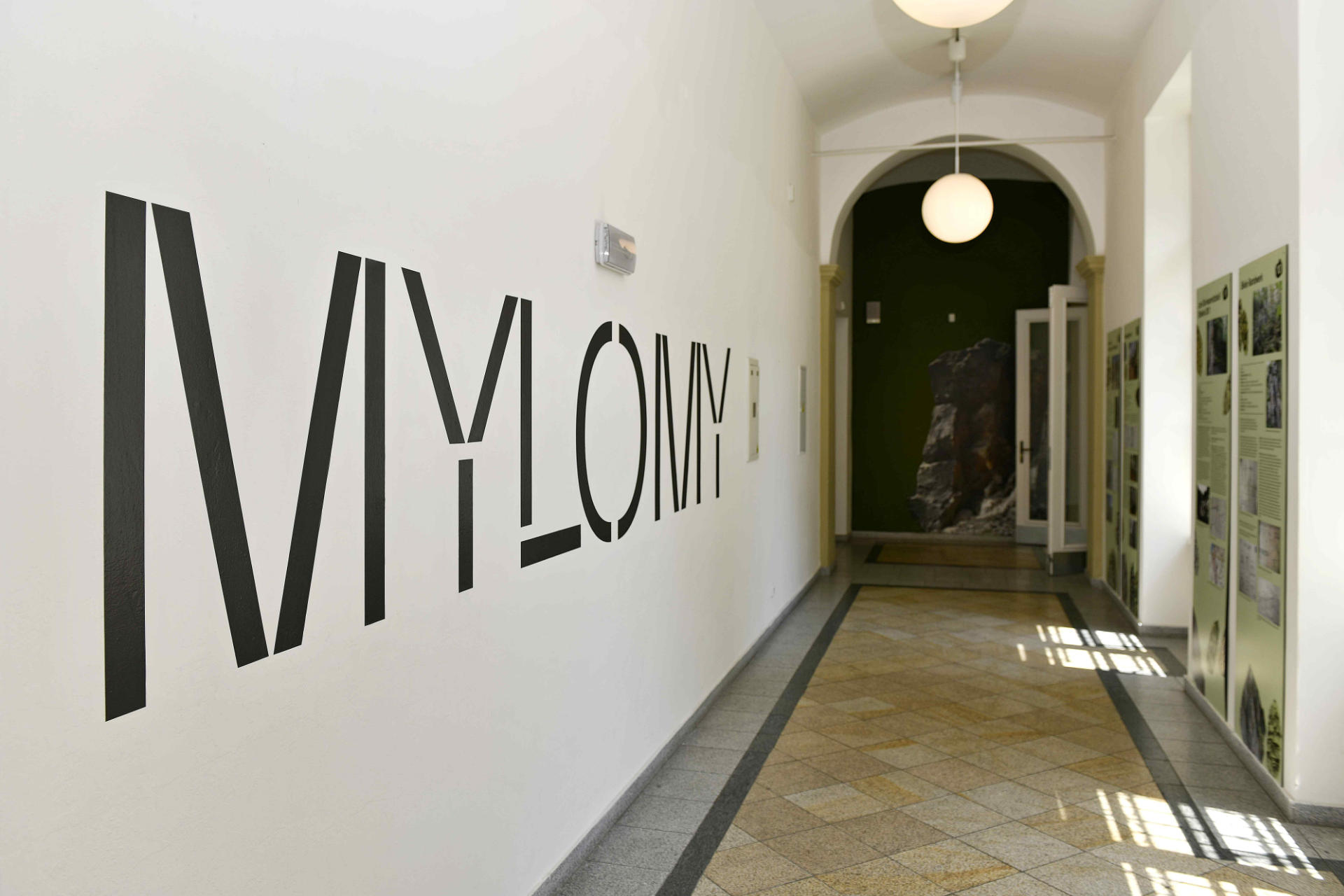
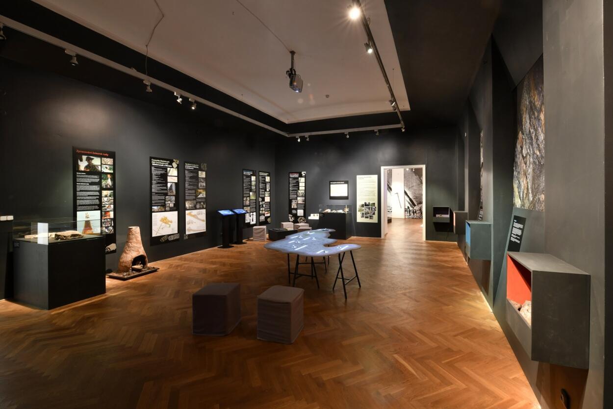

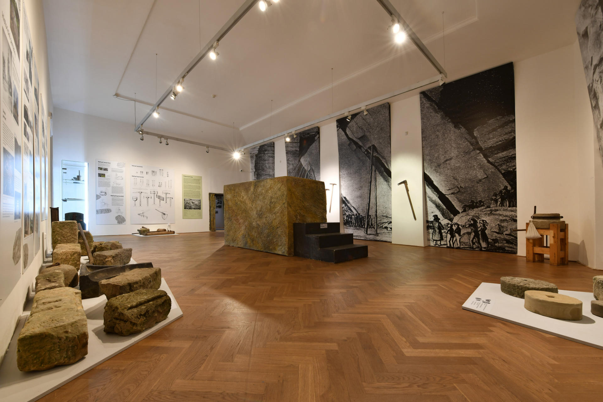

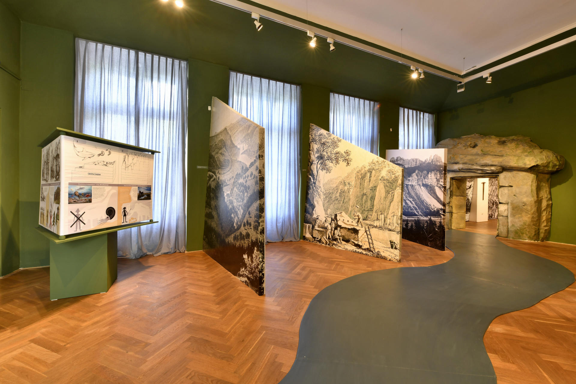
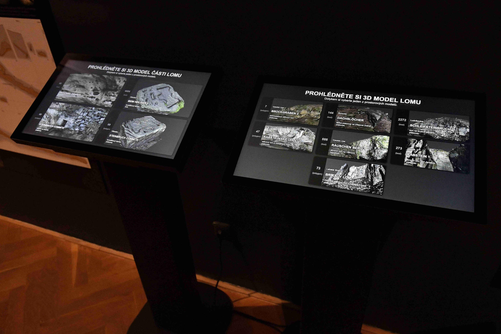
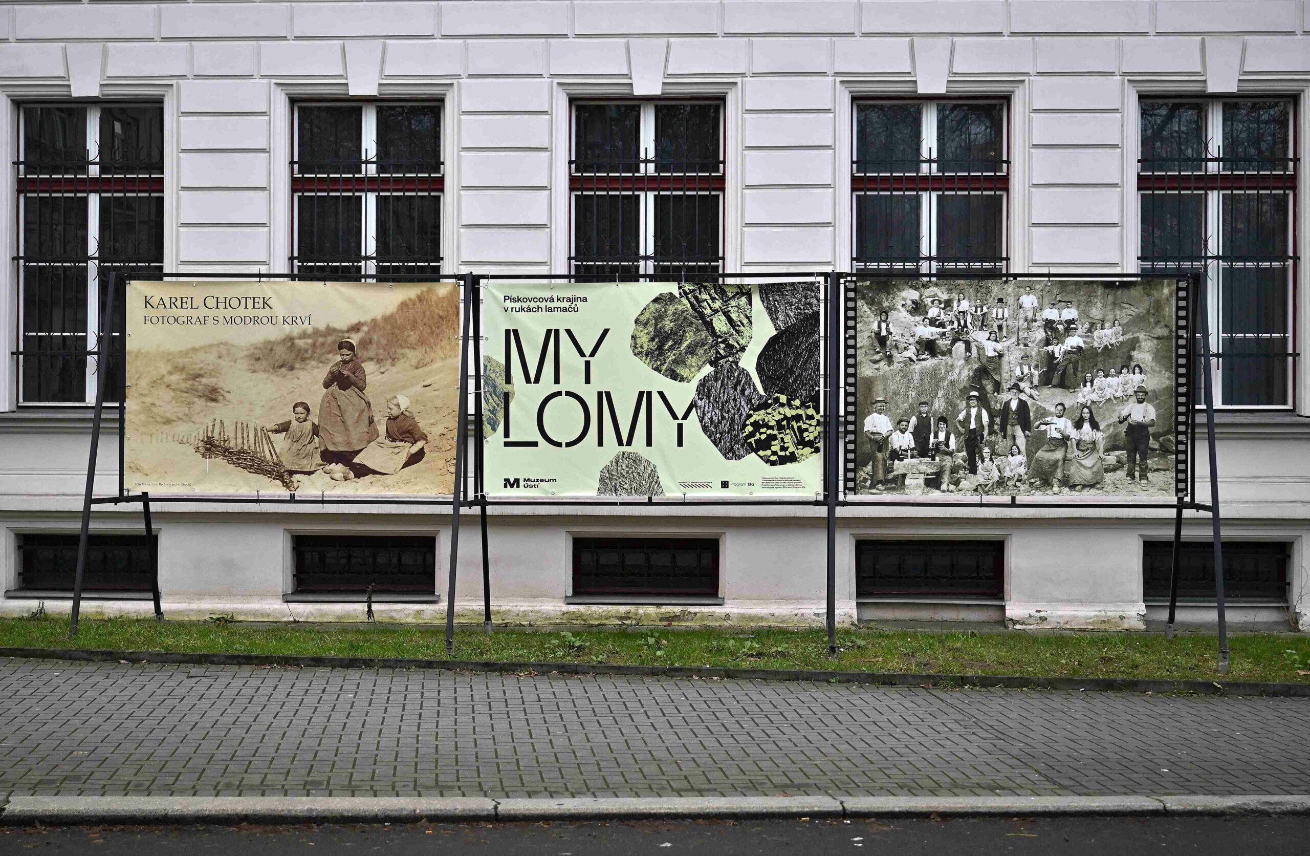
Photo gallery from the preparation of the exhibition:
Photo gallery from the opening:
Reportage from the opening of the exhibition Youtube
Reportage by Naseveru.net
Video tour of the exhibition Youtube
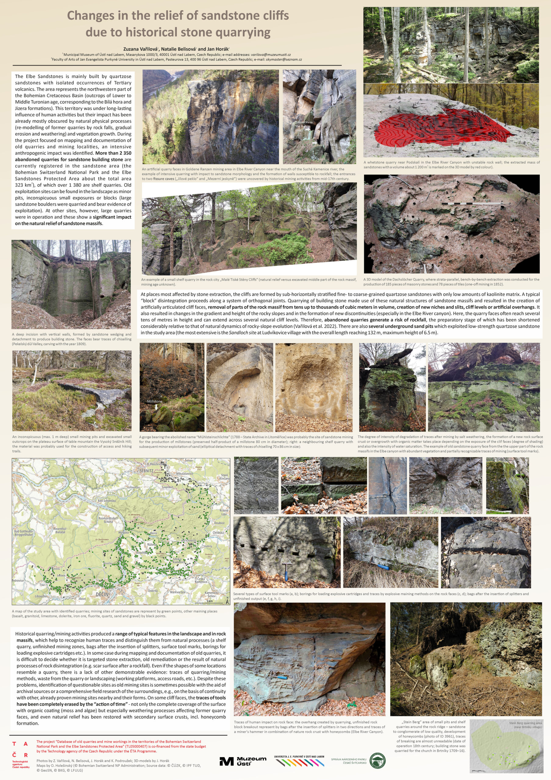
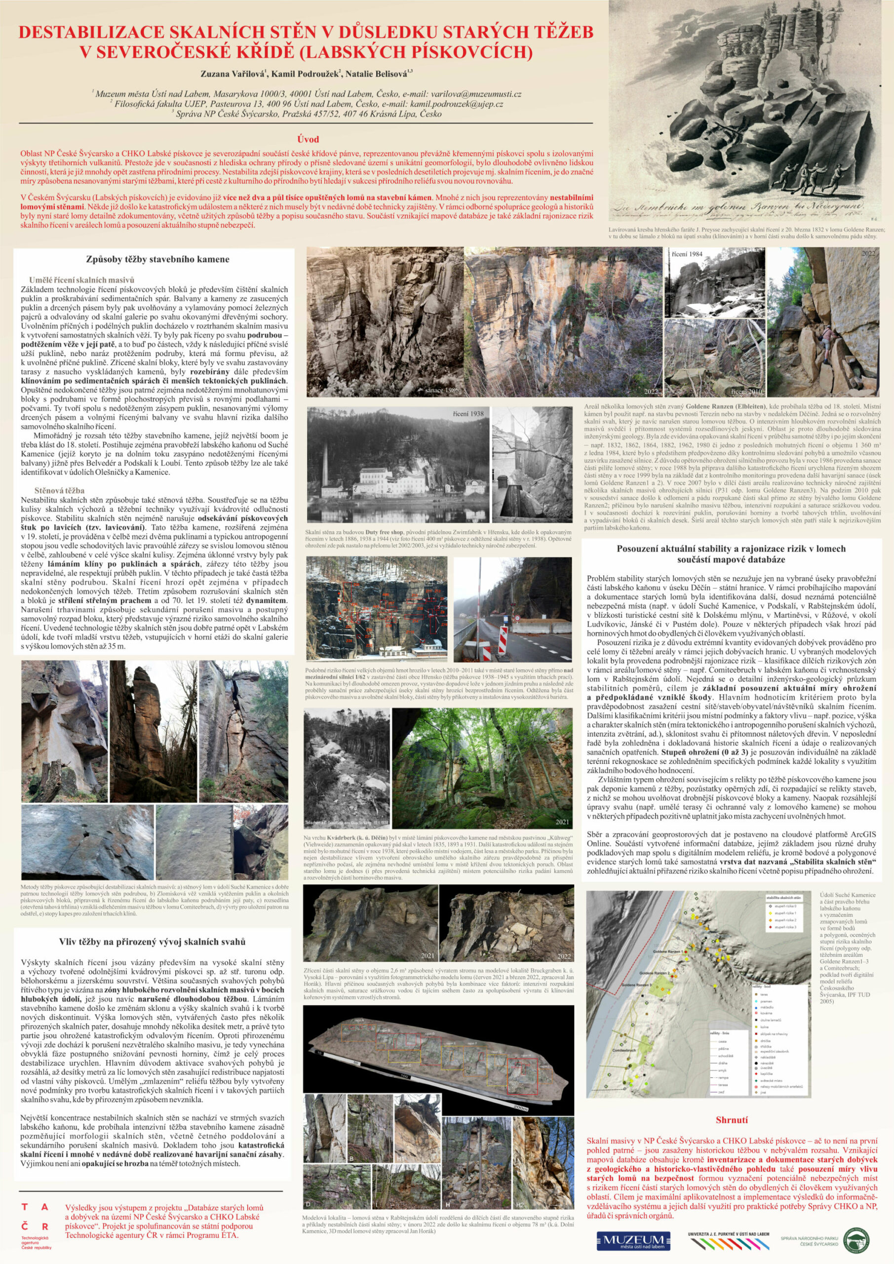
- Scientific paper 1
STABILITY DETERIORATION OF CLIFF FACES DUE TO HISTORICAL MINING IN THE ELBE SANDSTONES PROTECTED AREA
Zuzana Vařilová, Kamil Podroužek, Natalie Belisová, Jan Horák
Keywords: sandstone, quarry face, stability, rockfall, hazards, risk scaling, methodology, Bohemian Switzerland
Summary:
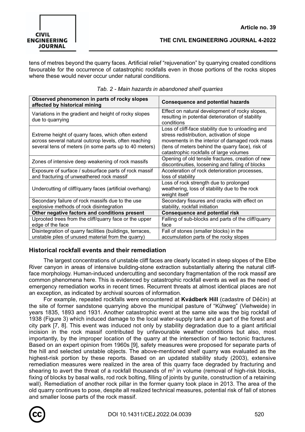
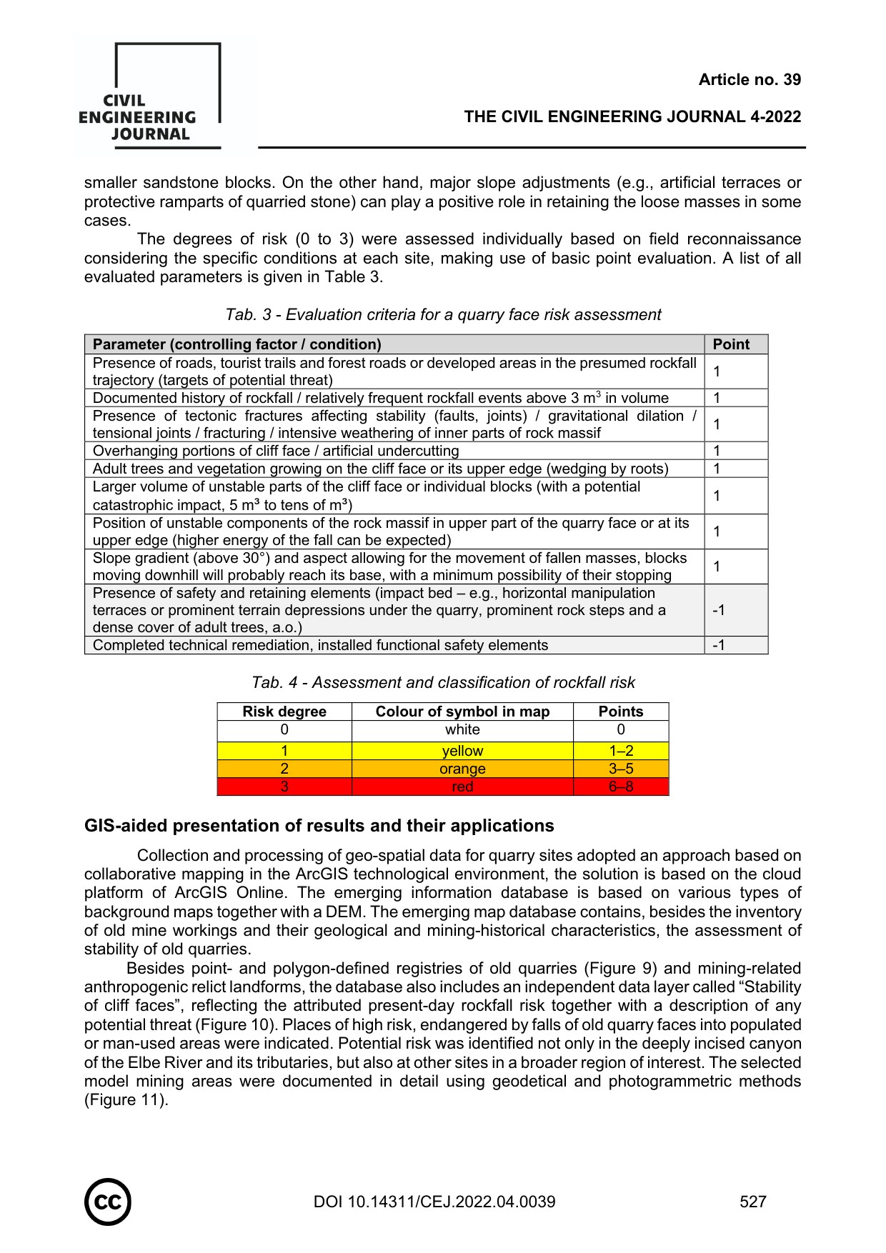
The study presents problems of instabilities in sandstone landscapes induced by anthropogenic interventions, especially by unreclaimed old mining sites. Old quarries often pose elevated risk of catastrophic rockfalls, the preparatory phase of which is notably shortened compared to natural dynamics of rocky-slope evolution. The survey and documentation of abandoned quarries in the Bohemian Switzerland NP and Elbe Sandstones PLA involved risk assessment in quarries in selected areas into three basic grades. A more detailed risk scaling was provided for model sites. The classification criteria include slope inclination, the degree of tectonic and anthropogenic degradation of outcrops, the height of the faces, rock properties and the degree of weathering, rockfall history at the given site, the presence of naturally introduced woody plants, and especially the degree of real risk to roads/buildings/population/visitors. Besides historically documented rockfall events, several relatively recent events are described from years 2021–2023. As a part of a new map database of historical quarries, a special layer of potentially dangerous sites was established. Such sites were evaluated as prone to collapses of parts of old quarry faces into populated areas or areas frequently utilized by man. The highest concentration of unstable rock massifs lies in steep slopes of the Elbe River canyon, where intensive mining of building stone was operated between the end of the 18th century and the early 20th century. This resulted in a large-scale alteration of cliff face morphologies including commonplace undercutting and secondary degradation (e.g., by using explosives). This is evidenced by the occurrence of catastrophic rockfalls as well as the many installed technical measures (Kvádrberk or Pastýřská stěna hills in Děčín, in the reach between the Suchá Kamenice River and Belvedér, or in the Hřensko area).
Reference: Vařilová, Z., Podroužek, K., Belisová, N. & Horák, J. (2022). STABILITY DETERIORATION OF CLIFF FACES DUE TO HISTORICAL MINING IN THE ELBE SANDSTONES PROTECTED AREA. Stavební Obzor – Civil Engineering Journal, 31(4), 516–532. DOI: https://doi.org/10.14311/CEJ.2022.04.0039


- Scientific paper 2
THE USE OF PROVENANCE ANALYSIS IN THE IDENTIFICATION OF SOURCES OF SANDSTONE BUILDING STONE FOR SELECTED HISTORICAL OBJECTS IN THE DĚČÍN AND LITOMĚŘICE AREAS
Kamil Podroužek – Jiří Adamovič – Natalie Belisová
Keywords: Provenance material analysis, Sandstone, Historical buildings, Cultural heritage, History of construction, Historical quarries, Bohemian Switzerland, Northern Bohemia
Summary:
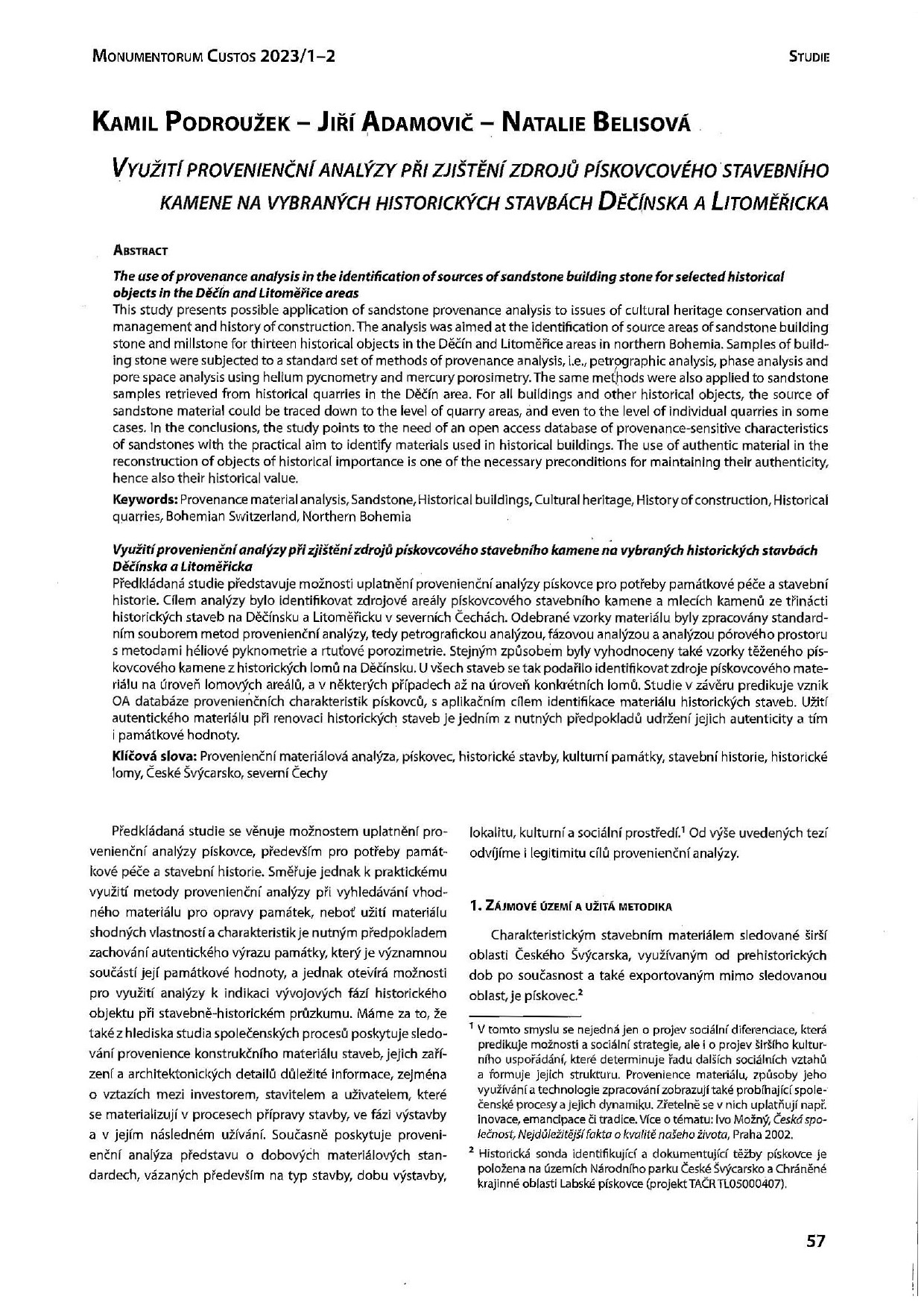
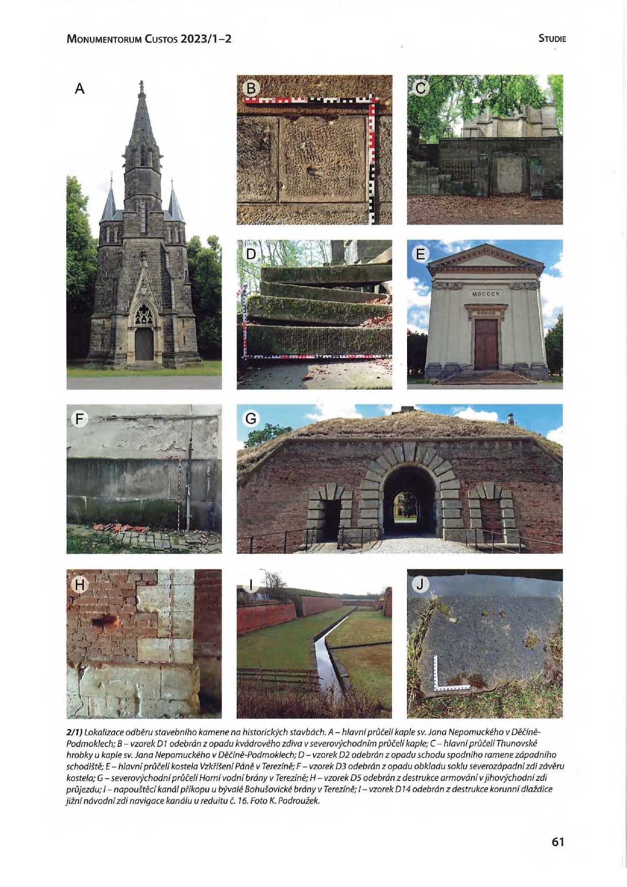
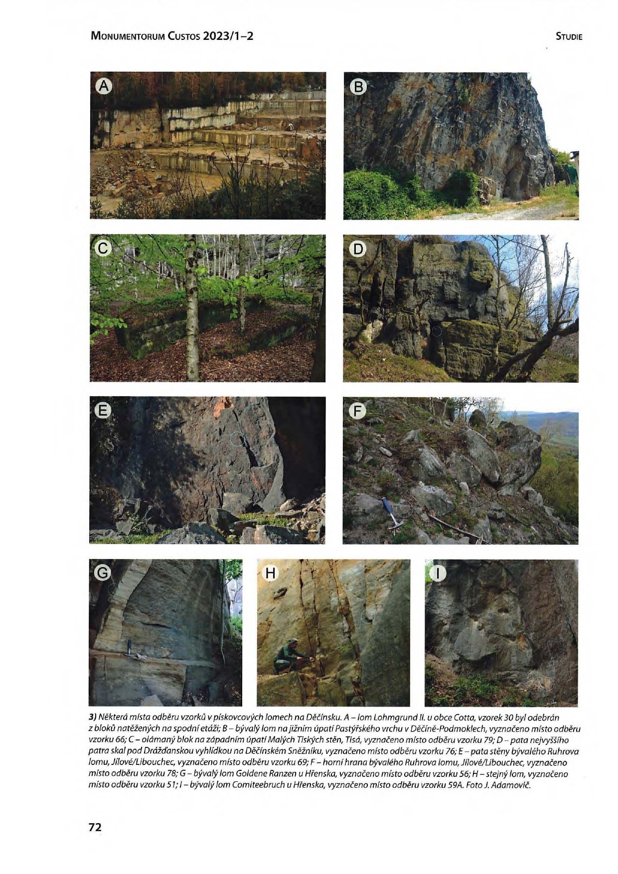
The study presents possible application of sandstone provenance analysis to issues of cultural heritage conservation and management and history of construction. The analysis was aimed at the identification of source areas of sandstone building stone and millstone for thirteen historical objects in the Děčín and Litoměřice areas in northern Bohemia. Samples of building stone were subjected to a standard set of methods of provenance analysis, i.e., petrographic analysis, phase analysis and pore space analysis using helium pycnometry and mercury porosimetry. The same methods were also applied to sandstone samples retrieved from historical quarries in the Děčín area. For all buildings and other historical objects, the source of sandstone material could be traced down to the level of quarry areas, and even to the level of individual quarries in some cases. In the conclusions, the study points to the need of an Open Access database of provenance-sensitive characteristics of sandstones with the practical aim to identify materials used in historical buildings. The use of authentic material in the reconstruction of objects of historical importance is one of the necessary preconditions for maintaining their authenticity, hence also their historical value.
Reference: Podroužek, K., Adamovič, J. Belisová, N. (2023). VYUŽITÍ PROVENIENČNÍ ANALÝZY PŘI ZJIŠTĚNÍ ZDROJŮ PÍSKOVCOVÉHO STAVEBNÍHO KAMENE NA VYBRANÝCH HISTORICKÝCH STAVBÁCH DĚČÍNSKA A LITOMĚŘICKA. Monumentorum Custos, časopis pro památky severozápadních Čech, 16(1-2), 57–92.

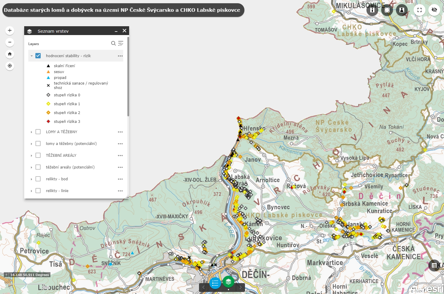
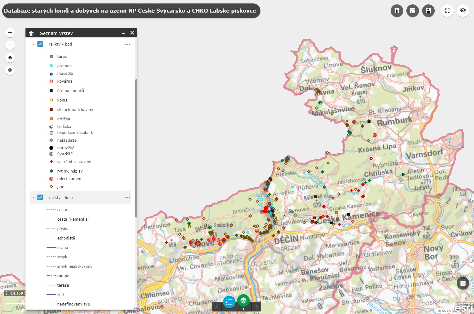
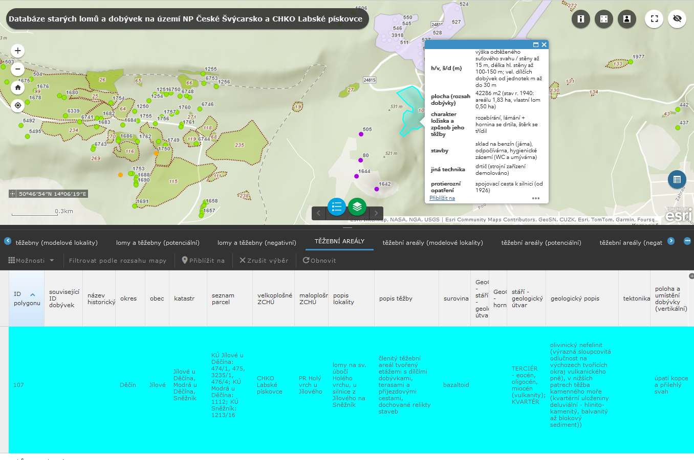
- MAP DATABASE (a set of maps with professional contents accompanied by an information database)
Web application of the map database of old quarries and mining sites: HERE
Collection and processing of geolocation and descriptive data for the quarries and mining sites was designed using the methods of collaborative mapping. The infrastructure of data and applications was created in the ArcGIS Online cloud environment of the ESRI company. This is a complex map and analytical solution, which provides environment for the configuration and administration of 3D databases, an interactive web-based map browser, tools for sharing the contents through data-management services, environment for a central administration of identities and accesses of the users, licences and contents of the organization. Besides the web-based maps, the work with data made use of a fully integrated ArcGIS Online with applications ArcGIS Pro (use of advanced GIS tools) and ArcGIS Field Maps (browsing and collection of data in the field, support of offline editing with controlled synchronization of contents).
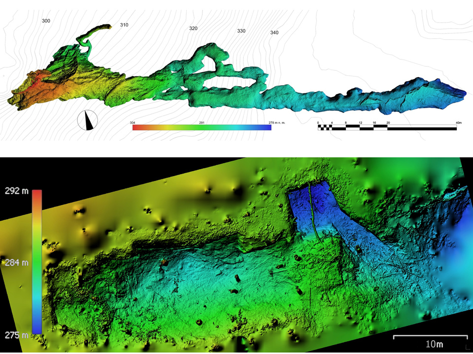
Data collection was realized by using thematic geodatabases – quarries (points for individual quarries and mining sites, polygons for areally extensive quarries and quarrying areas); relicts (points and lines representing recovered remains after mining-related human activities – e.g., chutes, road network, constructions, technological background of quarries, half-finished products, carvings etc.); evaluation of stability – risk (points containing the evaluation of hazard and risk in abandoned quarries in selected parts of the area of interest). The layer of model sites displays 10 representative mining sites or areas described in the register card and in appendices in such detail which goes well beyond basic documentation (reg. cards, detailed description of mining history, plans and 3D models of the mining sites and other documentation). A special category is represented by potential quarries, which meet the criteria for an abandoned quarry or mining site although no evidence of mining is factually available: data, archived materials and undisputed identification traces in the field are missing.
A specific data model (scheme) and numerical categories were applied to each of the themes solved. The essential parameter of the characteristics of the mining sites is the type of the material/mineral exploited (“material”), which is also reflected in the basic colour scale of the documentation points /polygons in the map project.
Besides professional attributes, each element of the database is accompanied by identification particulars of the record administrator and by the appendix with visual documentation. Recordings of positions in the field were primarily based on localization of mobile devices through integrated GPS receivers, and the precision of the positions was further enhanced using the digital elevation model.
The set of accompanying topographical and thematic maps consisted especially of publicly available browsing services: Basic topographic map of the Czech Republic, Orthophoto of the Czech Republic, DEM 5G, Registry of Territorial Identification, Addresses and Real Estate (RÚIAN), GeoČR 50 and the Central Register of Nature Conservation (ÚSOP).
Data within the agreed extent can be shared in formats ESRI File Geodatabase, Shapefile, GeoJSON, Geopackage KML, CSV or via browsing services. One of the methods to make data accessible is through an interactive web map application. Publication of two types is presumed: a basic one with browsing functions for the wide public and an advanced one allowing work with data for professional institutions. (Moreover, a layer of relicts is accessible to selected users and institutions).


Examples of 3D models of quarries and relics: